Environmental Planning
Land use planning affects almost every aspect of life in Ontario. Environmental Land Use policies allow local Planning Boards and Councils to set goals and help communities grow while managing our land and resources. Conservation Authorities (CA’s) provide input to member municipalities to help ensure that planning decisions protect damage to property or injury to residents in proximity to Natural Hazards such as flooding, erosion and slope failures.
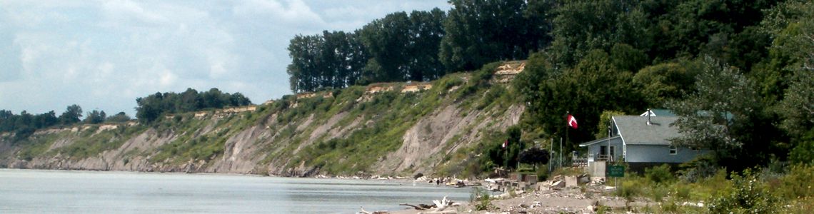
Recognizing that natural resources are best managed on a watershed basis, the Catfish Creek Conservation Authority (CCCA) promotes the conservation of forests, waters and wetlands within the tributaries of Catfish Creek, Silver Creek and along the Lake Erie Shoreline. CA’s are involved in the review of planning applications under the Planning Act in three ways: as an agency with delegated responsibilities for the review of natural hazards; as a technical advisor; and as a commenting agency.
Staff at our office can provide resource and hazard land mapping to help you protect environmentally sensitive areas and ensure that development has regard for natural physical processes near your property.
Environmental Regulations
In 2024, the Province legislated Conservation Authorities throughout Ontario to adopt a more consistent approach to regulating development in proximity to environmental hazards. Pursuant to the Conservation Authorities Act, Ontario Regulation 41/24 – Prohibited Activities, Exemptions and Permits, was approved by the Province and adopted by the CCCA Board of Directors.
Although it is not necessary to map a feature before it can be regulated, the CCCA has carried out wetland, flood plain and shoreline studies to help identify some of the unique natural characteristics of the watershed. Provincial and Authority guidance documents were used to establish Regulation Limits within the CCCA jurisdiction.
Residents can view their property and identify whether their property is affected by Ontario Regulation 41/24. It is important to note that in some cases your property may cross the boundary of two Conservation Authorities. In this case you should contact both conservation authorities to determine if your property is within a regulated area.
The information made available on this site is not intended to constitute advice nor is it to be used as a substitute for specific advice from Catfish Creek Conservation Authority or qualified professionals. The information made available on this site is intended for illustrative and informational purposes only.
For further inquires and/or information in regards to natural hazards present on their property, residents are encouraged to reach out to CCCA staff at 519-773-9037 ext. 18 or [email protected].
Section 1(1) of Ontario Regulation 41/24 provides the following definition of development.
Development means:
a) The construction, reconstruction, erection or placing of a building or structure of any kind,
b) Any change to a building or structure that would have the effect of altering the use or potential use of the building or structure, increasing the size of the building or structure or increasing the number of dwelling units in the building or structure,
c) Site grading, or
d) The temporary or permanent placing, dumping or removal of any material, originating on the site or elsewhere.
The Conservation Authority now regulates:
- development in river or stream valleys, wetlands, shorelines and hazardous lands and associated allowances;
- the straightening, changing, diverting or interfering in any way with the existing channel of a river, creek, stream, watercourse or for changing or interfering in any way with a wetland; and
- other areas where, in the opinion of the Minister, development should be prohibited or regulated or should require the permission of the Authority.
Legal Inquiries
Legal Inquiries are another important aspect of flood plain management. The Authority responds to inquiries from lawyers, realtors, and the general public who are interested in knowing whether or not a property is located within a flood or erosion prone area.